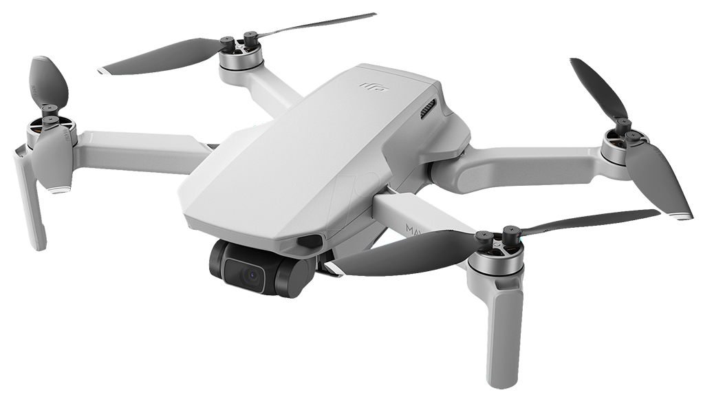
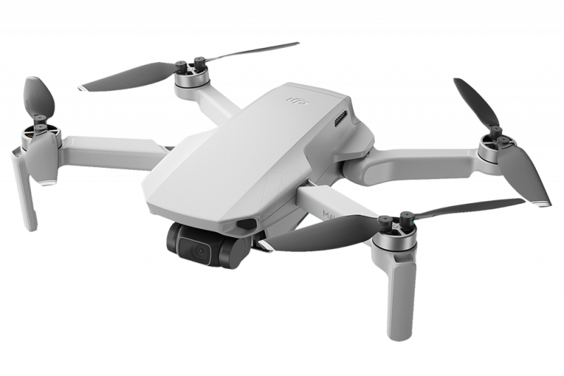
Aircraft
Takeoff Weight [1]
< 249 g
Dimensions
Folded: 138×81×58 mm (L×W×H)
Unfolded: 159×203×56 mm (L×W×H)
Unfolded (with propellers): 245×289×56 mm (L×W×H)
Unfolded: 159×203×56 mm (L×W×H)
Unfolded (with propellers): 245×289×56 mm (L×W×H)
Diagonal Distance
213 mm
Max Ascent Speed
5 m/s (S Mode)
3 m/s (N Mode)
2 m/s (C Mode)
3 m/s (N Mode)
2 m/s (C Mode)
Max Descent Speed
3.5 m/s (S Mode)
3 m/s (N Mode)
1.5 m/s (C Mode)
3 m/s (N Mode)
1.5 m/s (C Mode)
Max Speed (near sea level, no wind)
16 m/s (S Mode)
10 m/s (N Mode)
6 m/s (C Mode)
10 m/s (N Mode)
6 m/s (C Mode)
Max Service Ceiling Above Sea Level
4000 m
Max Flight Time
31 mins (measured while flying at 4.7 m/s in windless conditions)
Max Wind Speed Resistance
8.5-10.5 m/s (Scale 5)
Max Tilt Angle
40° (S Mode)
25° (N Mode)*
25° (C Mode)*
* Up to 40° under strong winds
25° (N Mode)*
25° (C Mode)*
* Up to 40° under strong winds
Max Angular Velocity (by default)*
130°/s (S Mode)
60°/s (N Mode)
30°/s (C Mode)
* Can be adjusted to 250°/s with the DJI Fly app
60°/s (N Mode)
30°/s (C Mode)
* Can be adjusted to 250°/s with the DJI Fly app
Operating Temperature
0° to 40°C (32° to 104°F)
Operating Frequency [2]
2.400-2.4835 GHz, 5.725-5.850 GHz
Transmitter Power (EIRP)
2.400-2.4835 GHz
FCC ≤ 26 dBm
CE ≤ 20 dBm
SRRC ≤ 20 dBm
5.725-5.850 GHz
FCC ≤ 26 dBm
CE ≤ 14 dBm
SRRC ≤ 26 dBm
FCC ≤ 26 dBm
CE ≤ 20 dBm
SRRC ≤ 20 dBm
5.725-5.850 GHz
FCC ≤ 26 dBm
CE ≤ 14 dBm
SRRC ≤ 26 dBm
Global Navigation Satellite System (GNSS)
GPS+GLONASS+GALILEO
Hovering Accuracy Range
Vertical: ±0.1 m (with Vision Positioning), ±0.5 m (with GPS Positioning)
Horizontal: ±0.3 m (with Vision Positioning), ±1.5 m (with GPS Positioning)
Gimbal
Mechanical Range
Tilt: -110° to 35°
Roll: -35° to 35°
Pan: -20° to 20°
Roll: -35° to 35°
Pan: -20° to 20°
Controllable Range
Tilt: -90° to 0° (default setting) -90° to +20° (extended)
Stabilization
3-axis (tilt, roll, pan)
Max Control Speed (tilt)
100°/s
Angular Vibration Range
±0.01°
Sensing System
Downward
Hovering Range: 0.5-10 m
Operating Environment
Non-reflective, discernable surfaces
Diffuse reflectivity (> 20%,such as cement pavement)
Adequate lighting (lux > 15, Normal exposure environment of indoor fluorescent lamp)
Diffuse reflectivity (> 20%,such as cement pavement)
Adequate lighting (lux > 15, Normal exposure environment of indoor fluorescent lamp)
Camera
Sensor
1/2.3” CMOS
Effective Pixels: 12 MP
Lens
FOV: 83°
35 mm format equivalent: 24 mm
Aperture: f/2.8
Focus range: 1 m to ∞
35 mm format equivalent: 24 mm
Aperture: f/2.8
Focus range: 1 m to ∞
ISO
Video:
100-3200 (Auto)
100-3200 (Manual)
Photos:
100-3200 (Auto)
100-3200 (Manual)
100-3200 (Auto)
100-3200 (Manual)
Photos:
100-3200 (Auto)
100-3200 (Manual)
Shutter Speed
Electronic Shutter: 4-1/8000 s
Max Image Size
4:3: 4000×3000
16:9: 4000×2250
16:9: 4000×2250
Still Photography Modes
Single Shot
Interval: JPEG: 2/3/5/7/10/15/20/30/60 s
JPEG+RAW: 5/7/10/15/20/30/60 s
Auto Exposure Bracketing (AEB): 3 bracketed frames at 2/3 EV Bias
Panorama: Sphere, 180°, and Wide-angle
Interval: JPEG: 2/3/5/7/10/15/20/30/60 s
JPEG+RAW: 5/7/10/15/20/30/60 s
Auto Exposure Bracketing (AEB): 3 bracketed frames at 2/3 EV Bias
Panorama: Sphere, 180°, and Wide-angle
Video Resolution
4K: 3840×2160 @ 24/25/30fps
2.7K: 2720×1530 @ 24/25/30/48/50/60fps
FHD: 1920×1080 @ 24/25/30/48/50/60fps
2.7K: 2720×1530 @ 24/25/30/48/50/60fps
FHD: 1920×1080 @ 24/25/30/48/50/60fps
Max Video Bitrate
100 Mbps
Zoom Range
4K: 2x
2.7K: 3x
FHD: 4x
2.7K: 3x
FHD: 4x
QuickShot Modes
Dronie,
Helix,
Rocket,
Circle,
Boomerang
Helix,
Rocket,
Circle,
Boomerang
Supported File Formats
FAT32 (≤ 32 GB)
exFAT (> 32 GB)
exFAT (> 32 GB)
Photo Formats
JPEG/DNG (RAW)
Video Formats
MP4 (H.264/MPEG-4 AVC)
Remote Controller & Video Transmission
Operating Frequency
2.400-2.4835 GHz, 5.725-5.850 GHz
Max Transmission Distance (unobstructed, free of interference) [3]
10 km (FCC)
6 km (CE)
6 km (SRRC)
6 km (MIC)
6 km (CE)
6 km (SRRC)
6 km (MIC)
Signal Transmission Ranges (FCC) [4]
Strong Interference (urban landscape, limited line of sight, many competing signals): Approx. 3 km
Medium Interference (suburban landscape, open line of sight, some competing signals): Approx. 6 km
Low Interference (open landscape abundant line of sight, few competing signals): Approx. 10 km
Medium Interference (suburban landscape, open line of sight, some competing signals): Approx. 6 km
Low Interference (open landscape abundant line of sight, few competing signals): Approx. 10 km
Operating Temperature
-10° to 40° C (14° to 104° F)
Transmission Power (EIRP)
2.400-2.4835 GHz
FCC ≤ 26 dBm
CE ≤ 20 dBm
SRRC ≤ 20 dBm
MIC ≤ 20 dBm
5.725-5.850 GHz
FCC ≤ 26 dBm
CE ≤ 14 dBm
SRRC ≤ 26 dBm
FCC ≤ 26 dBm
CE ≤ 20 dBm
SRRC ≤ 20 dBm
MIC ≤ 20 dBm
5.725-5.850 GHz
FCC ≤ 26 dBm
CE ≤ 14 dBm
SRRC ≤ 26 dBm
Battery Capacity
5200 mAh
Voltage
1200 mA 3.6 V (Android)
700 mA 3.6 V (iOS)
700 mA 3.6 V (iOS)
Supported Mobile Device Size
180×86×10 mm (Height×Width×Thickness)
Supported USB Port Types
LightningMicro USB (Type-B) USB-C
Video Transmission System
OcuSync 2.0
Live View Quality
Remote Controller: 720p/30fps
Max Bitrate
8 Mbps
Latency (depending on environmental conditions and mobile device)
About 200 ms
Charger
Input
100-240 V, 50/60 Hz, 0.5 A
Output
12V 1.5 A / 9V 2A / 5V 3A
Rated Power
18 W
Intelligent Flight Battery
Battery Capacity
2250 mAh
Voltage
7.7 V
Charging Voltage Limit
8.8 V
Battery Type
LiPo 2S
Energy
17.32 Wh
Weight
86.2 g
Charging Temperature
5° to 40°C (41° to 104°F)
Max Charging Power
29 W
App
Name
DJI Fly
Required Operating System
iOS v10.0 or laterAndroid v6.0 or later
Supported SD Cards
Supported SD Cards
UHS-I Speed Class 3 or above is required. A list of recommended microSD cards can be found below.
Recommended microSD Cards
16 GB: SanDisk Extreme
32 GB: Samsung Pro Endurance, Samsung Evo Plus, SanDisk Industrial, SanDisk Extreme V30 A1, SanDisk Extreme V30 A2, SanDisk Extreme Pro V30 A1, SanDisk Extreme Pro V30 A2, Lexar 633x, Lexar 667x
64 GB: Samsung Pro Endurance, Samsung Evo Plus, SanDisk Extreme V30 A2, Lexar 633x, Lexar 667x, Lexar 1000x, Lexar High Endurance, Toshiba EXCERIA M303 V30 A1, Netac Pro V30 A1
128 GB: Samsung Evo Plus, SanDisk Extreme V30 A2, SanDisk Extreme Plus V30 A1, SanDisk Extreme Plus V30 A2, Lexar 633x, Lexar 667x, Lexar 1000x, Lexar High Endurance, Toshiba EXCERIA M303 V30 A1, Netac Pro V30 A1
256 GB: SanDisk Extreme V30 A2
Footnotes
-
Footnotes
-
1. The standard weight of the aircraft (including battery, propellers, and a microSD card) is 242 grams. Actual poduct weight may vary. Registration is not required in some countries and regions. Check local rules and regulations before use. These specifications have been determined through tests conducted with the latest firmware. Firmware updates can enhance performance, so updating to the latest firmware is highly recommended.
2. Due to local policy and regulation restrictions, the 5.8 GHz frequency band is currently banned in certain countries, including but not limited to Japan, Russia, Israel, Ukraine, and Kazakhstan. Please use the 2.4 GHz frequency band when operating in these locations. Always check local rules and regulations before use, as they may change over time.
3. Maximum flight range specification is a proxy for radio link strength and resilience, not aircraft battery capability. It only refers to the maximum, one-way flight distance. Data was measured in an open environment without interference. Please pay attention to the return prompt on the DJI Fly app during actual flight. Refer to the following applicable standard in different countries and regions:
FCC: United States, Australia, Canada, Hong Kong, Taiwan, Chile, Colombia, Puerto Rico, and other regions;
SRRC: Mainland China;
CE: UK, Russia, France, Germany, Portugal, Spain, Switzerland, Macau, New Zealand, UAE, and other regions;
MIC: Japan.
4. Data is tested under different standards in open areas free of interference. It only refers to the maximum, one-way flight distance without considering Return to Home. Please pay attention to RTH prompts in the DJI Fly app during actual flight.